Drone services
With Ofiteat, the most advanced technological means in the industry and one of the most experienced teams of pilots, engineers and experts in topography and thermography will be at your disposal to offer you the solutions your company needs, whatever drone service you are looking for.
From topographic surveys to precision agriculture, we have been performing drone services for more than 20 years on three continents, successfully overcoming the most ambitious challenges for and on behalf of our clients. Predictive, preventive and corrective maintenance inspections are now faster and safer thanks to our thermography service. We detect problems in the energy production of photovoltaic plants, in power lines and substations, using drones with thermographic cameras.
Why choose our drone services?
Because we were one of the pioneers at international level in incorporating drones to all kinds of tasks associated with topography, thermography, monitoring of construction sites or precision agriculture.
Our drones have been assembled by our own team of experts using the highest quality materials in the market, integrating in them all kinds of technologies and systems that allow us to adapt this type of devices to meet the most demanding needs of small, medium and large projects.
Our technical team is composed of official UAV-RPAS pilots trained to operate drones with advanced technology, such as multi-rotor platforms and gliders, and RGB, multispectral and thermal data capture systems; and has all the necessary certificates and licenses to operate internationally, complying with the current regulations in the UAV-RPAS sector.
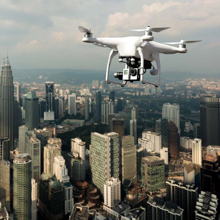
Topographic surveys with drones
In Ofiteat we have always decided to bet on innovation, and proof of this is that we are pioneers in the incorporation of drones to topography.
Since their appearance at the commercial and civil level, we have identified the possibilities of these tools for the performance of our surveying services. Today, we can affirm that they allow us to optimize means, performance and offer solutions completely adapted to our customers.
10 reasons to use drones for topographic surveys
- Increased efficiency and time savings: Drones allow for much faster topographic surveys than traditional methods, significantly reducing the time spent on surveys.
- Access to remote and dangerous locations: Drones can reach hard-to-reach or dangerous areas without jeopardizing the safety of surveyors.
- Measurement accuracy: Drones equipped with high-resolution sensors and cameras can capture survey data with high accuracy.
- Cost reduction: Costs associated with heavy equipment, additional personnel and transportation are reduced.
- Real-time monitoring and control: Allow accurate tracking of changes in the field during project execution.
- Higher resolution: Very high resolution images and orthophotos are obtained, allowing to work with a higher level of detail.
- Improved volumetric calculations: Drones, combined with appropriate software, allow volumetric calculations with higher accuracy than traditional methods.
- Generation of detailed 3D models: The data captured by drones can produce high-resolution digital terrain models and 3D maps.
- Increased occupational safety: By preventing surveyors from physically accessing hazardous areas, the risk of accidents is reduced.
- More complete data capture: Drones can obtain a dense point cloud (approximately 100 points per cubic meter), resulting in more accurate and detailed measurements of the terrain.
Thermography with drones
We are specialists in thermographic inspections for photovoltaic installations, power lines and wind turbine maintenance.
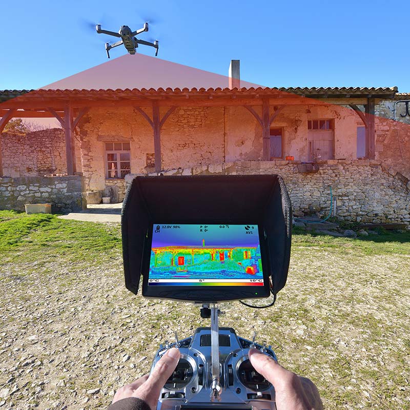
Thermography is the technique that helps us to determine the temperature of an object at a distance without the need to interact with it. This facilitates the mapping of installations and the detection of faults and malfunctions in the system and in networks for their correct maintenance. It is therefore a proactive discipline that has a direct impact on cost savings, detecting faults and locating them before the problems become more serious.
How we do it and why choose us
Methodology
We capture the infrared radiation of the electromagnetic spectrum, converting the radiated energy into temperature information. To achieve this result we use thermal cameras or thermovision, very sophisticated technological devices that capture the exact temperature of objects or spaces by means of a caloric system to record the temperature by infrared radiation continuously.
Advantages
Thermography has diverse applications in areas such as medicine, metallurgy, automotive or aerospace industry among others. Its use in industrial inspections has a direct impact on the operation of the same providing:
- Cost savings
- Preventive maintenance to anticipate the problem and correct it before it is too late.
- Avoid production losses
- Improved profitability by maximizing infrastructure performance.
- Reduced survey turnaround times through the use of drones
- Reducing operating costs by outsourcing maintenance.
Advantages of Ofiteat
At Ofiteat we have been pioneers in the implementation of thermography for the maintenance of industrial facilities. In addition:
- We are qualified thermographers and geopositioning experts.
- We have international experience
- We work with large companies
- We have our own equipment.
- We execute the project according to the budget.
- We streamline workflows by providing deliverables through a web portal.
- We provide guarantee on the projects
- We meet delivery deadlines.
- We have flexible and scalable teams.
In Ofiteat, the search for maximum efficiency and the constant effort in innovation have made us a thermography company able to offer our customers the most advanced thermographic solutions in the market with total guarantee of reliability, and operating in 4 continents.
Uses of thermographic analysis
Thermographic analysis is used to obtain the surface temperature distribution of the object to be inspected, creating a heat map showing hot or cold spots that will indicate anomalies in an installation or in materials or objects, if any.
Why is a thermographic analysis useful?
Thermographic analyses have many applications, as they are very useful in many different fields, such as building inspections or thermographic studies of photovoltaic installations, power lines and wind turbines.
What is infrared thermography?
Most equipment failures, whether electrical, mechanical or electronic, show a significant increase in temperature before they fail. Infrared thermography can detect heat patterns in the infrared wavelength spectrum that are invisible to the human eye. These heat patterns indicate deterioration of your parts before they can fail.
Infrared thermography detects the energy emitted by an object, converts it into visible temperature and displays the result as an infrared image. To be specific, infrared thermography is “image temperature” (thermography) “below red” (infrared).
With a thermal imaging camera, thermal images can be obtained without direct contact with the equipment. Thermographic cameras or infrared cameras capture radiometric thermal images containing the apparent temperature measurements for each pixel in the image.
With this feature, any temperature increase can be identified, and then each element and its condition can be analyzed independently.
Thermal imaging cameras solve problems related to energy or moisture in a building structure.
How does thermography help photovoltaic plants?
For the correct maintenance of photovoltaic installations, thermographic analyses should be performed on a regular basis, which will help to avoid yield losses in your plant and to protect against fires.
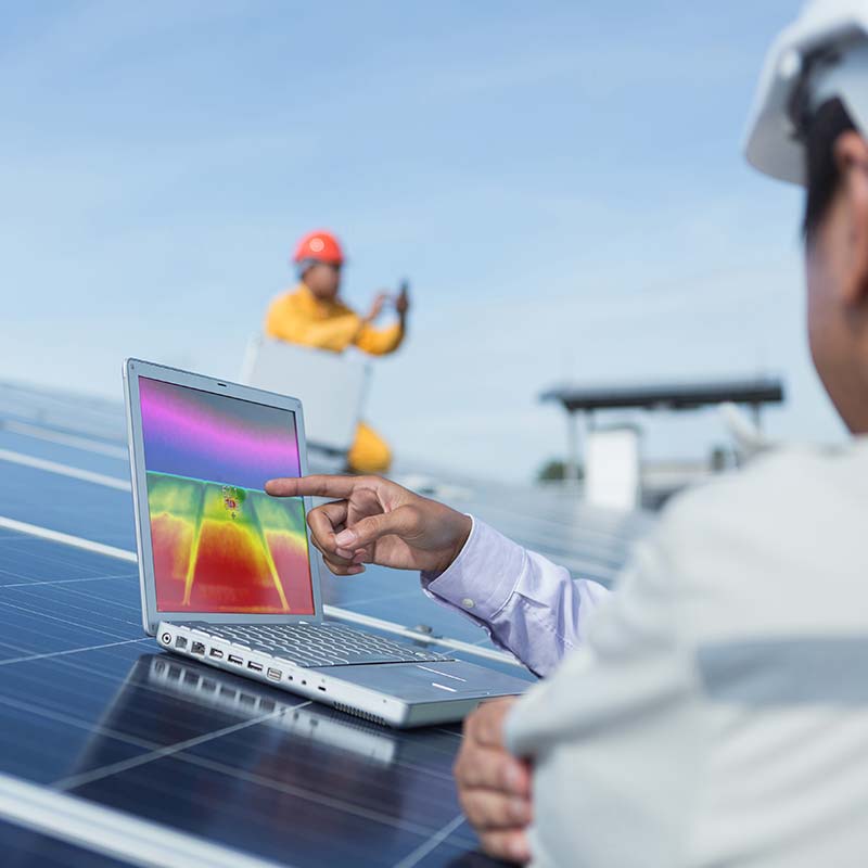
Performing an analysis of your PV plant will not require much time and you do not need to have any contact with the solar panel installation, possible thermal and temperature difference problems will be immediately visible and can be quickly solved.
The main faults are found by detecting hot spots. They can be diagnosed with a camera measuring changes in thermal properties and may be due to:
- Defective diodes.
- Short circuits in the solar cells.
- Accumulation of humidity and dirt.
- Breakage in the crystals of the modules.
- Loss of power due to bad connections.
- Deterioration due to the passage of time.
How does thermography help wind turbines?
With the help of drones and thermal cameras, we can perform thermographies in wind turbines to detect problems or carry out precise and continuous revisions.
Wind turbines are the means to transform air into wind energy into electricity.
The multispectral or thermographic cameras used are capable of providing data that cannot be seen with the naked eye. With these advanced techniques, inspections are carried out to discover possible cracks or structural damage to the shaft and blades, insulation losses in the nacelle, possible friction in the moving and rotating elements, as well as analysis of the performance of the power plant, its transformation centers and transmission lines.
How does thermography help power lines and power plants?
Thermography, being able to determine the surface temperature of a body without any kind of contact, is very helpful in detecting problems in power plants and high-voltage lines.
Another important point to highlight is that the measurements and studies are carried out with the power plant in operation, which makes it easier to detect possible problems and solve them in a shorter period of time.
Inspections must be carried out on a continuous basis since problems can appear at any time.
One of the most common faults is overheating of the elements due to high resistance.
The resistance usually appears in damaged, defective or already very worn connections, by increasing the resistance energy is lost in the form of heat, these problems must be solved as they put safety at risk by causing fires in electrical installations.
In Ofiteat we help you to perform any thermography service because we have the most qualified professionals and the most advanced tools, do not hesitate to contact us and we will inform you.
Operation and maintenance (O&M) of photovoltaic plants
“Prevention is better than cure” goes the saying and how right it is when we talk about the productivity of a photovoltaic plant.
Embarking on the production of energy through a photovoltaic installation is a great cost for any businessman, so hiring a maintenance service is essential to obtain the best possible performance of such a plant. proactive that directly affects cost savings, detecting failures and locating them before the problems go further.
How do we do it and why choose us?
The most common failures that can occur in a photovoltaic plant are due to failures in cell connections, busbar connections or diode failures. Preventing and detecting these failures is crucial to save costs, since early detection will minimize the possible failures that may occur.
In Ofiteat we have the best methodology to carry out a quality maintenance service in photovoltaic plants, so that they always work at full performance, thus saving time and money to the customer.
The appearance of more agile and cheaper thermographic cameras has been a great revolution in the industrial sector and has generated very competitive solutions at an economic level. Its application in the prevention and detection of faults in photovoltaic installations is a great advance.
We are pioneers
At Ofiteat we have the latest generation of thermographic cameras, capable of capturing images up to 3 cm pixel and we have gone a step further by installing our thermographic cameras on drones.
We were pioneers in the use of drones for topographic purposes to carry out surveys, site inspections, electrical lines, etc. We have all the necessary certificates and comply with national and international regulations in force. Our drones have the latest technology that make them the best in the industry.
The data capture with drones is fast and accurate, capable of covering up to 22 hectares per day, while an operator on foot with camera in hand needs up to 3 days to cover the same area.
Planning
Each photovoltaic plant is different and therefore we design a customized work plan for each one of them.
First of all, we plan the flight project to be carried out by the drone, which will be determined by the location, shape and surface of the plant, the weather conditions and the inclination of the sun’s rays according to the time of the year.
For a correct shot, we need the plates to be producing a minimum irradiance of 600 W/m2 and it is advisable to increase this value to 700 W/m2, which means that we need enough sunlight, so we will make the flight in a specific time slot that will ensure the best conditions. The wind can also interfere with the flight of the drone and should always be less than 30 km/h.
Avoid cloudy days that cause large reflections on the modules and can interfere with the accuracy of the results.
In real time, coarse errors can be seen and studied, to make more emphasis on those areas, being sometimes advisable flights of less definition to detect problem areas and later, detail flights in those detected areas.
Analysis
After a correct data capture, the data is processed by Ofiteat’s team of experts, using specific software such as PIX4D, FLIR, testo IRSoft, GRAYESS, or even our own developments. In just a few hours we can obtain reliable diagnoses of what has been observed.
And finally, we deliver detailed reports of the analysis of the collected data that will show failures such as breakages, bad connections.
By contracting Ofiteat’s inspection service, you will not only have the security of dealing with a team of experts, but you will also be able to anticipate possible breakdowns that can lead to costly repairs.
We have been dedicated to the maintenance of photovoltaic plants for years, many companies have trusted us. We not only operate in Spain, but we have expanded to Latin America and Japan.
For more information about our maintenance service (O&M), we will be happy to assist you.
Site monitoring with drones
Having a specialized company to carry out the monitoring of a work with drones is today a necessity for any medium and large-scale project that only a company with the most advanced technical and human resources in the sector can carry out.
In Ofiteat we have been offering all kinds of services associated with the monitoring of construction sites with drones for more than 20 years. Our devices have been personally assembled by our experts using the most reliable materials on the market and integrating the most advanced measurement and data analysis technologies in your system.
Our goal? To offer you the maximum reduction of logistic and operational costs in terms of site monitoring through our drone fleet, operated by official UAV-RPAS pilots and with our team of engineers and coordinators monitoring the works at all times.
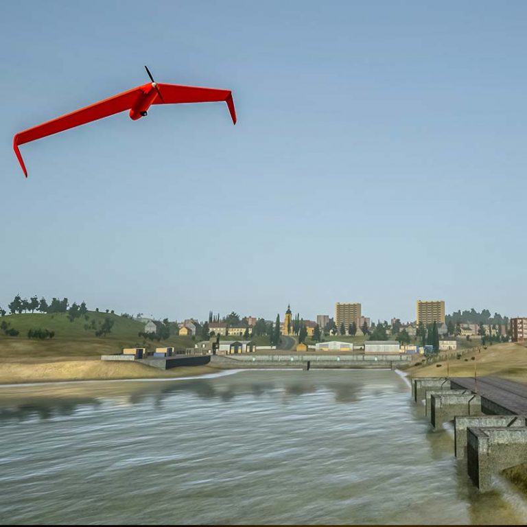
Why choose our drone site monitoring service?
Because we have carried out all types of work monitoring in several countries around the world and we have successfully faced the most adverse topographical and climatic conditions in the world.
Our technical means, on the one hand, and our human resources, on the other, have allowed us to overcome these challenges while maintaining at all times the utmost professionalism, reliability and commitment to our customers.
First, because our team of drone pilots has all the certifications, licenses and experience necessary to operate the most advanced machines in the sector in almost any country in the world.
Second, because these machines integrate in their system such innovative technologies as multirotor platforms, gliders or RGB, multispectral or thermal data capture.
Ofiteat, in fact, was one of the first companies to start using drones to monitor construction sites internationally. You can rest assured that, with us, your construction project monitoring on the ground is in good hands.
Precision agriculture
Ofiteat, in its eagerness to bet on innovation, is one of the companies that has invested more efforts and human capital in precision agriculture. Our fleet of drones and technicians, analyzing satellite images, allow us to carry out all kinds of tasks in crops of any size, allowing us to optimize costs to the maximum and obtain a greater return on investment in the long term.
Some of the tasks we perform using different types of drones are:
- Crop controls.
- Supervision of fumigated areas.
- Generation of crop area inventories.
- Detection of nutritional stress in crops.
- Indices related to crop quality.
- Detection of water stress, allowing a more efficient use of water.
- Early detection of crop diseases and pests.
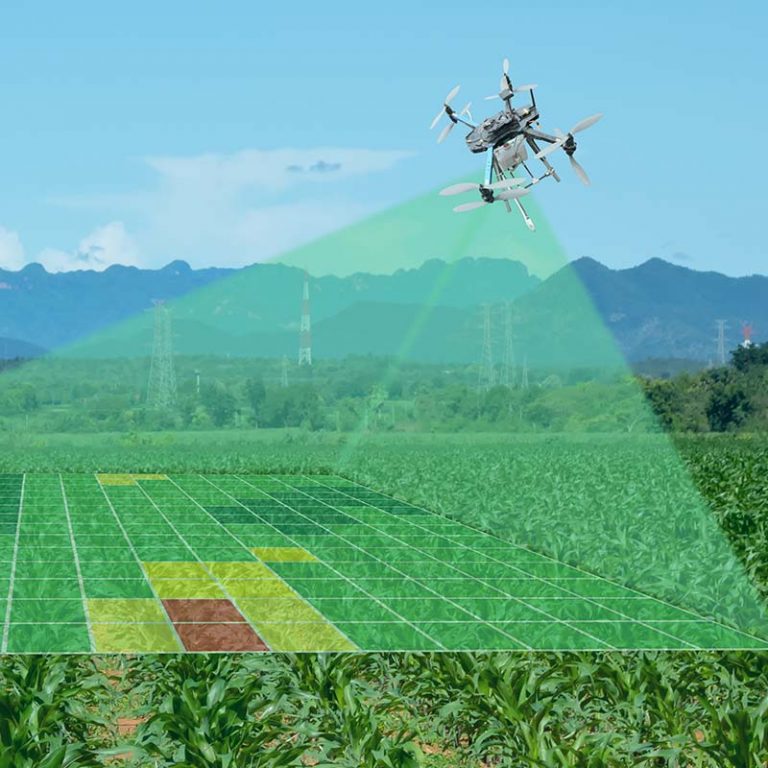
Why choose our precision farming service?
Because we have more than 5 years of experience in precision agriculture. We have successfully faced the most aggressive topographic and environmental conditions, always with the aim of offering our customers all kinds of solutions for the management and monitoring of their crops in the long term.
Our official UAV-RPAS pilots have all the necessary certifications and licenses to fly drones almost anywhere in the world.
Each of our drones has been modified with the objective of providing them with useful capabilities in the field of precision agriculture, topography and thermography.
From multispectral, thermal or RGB data capture to multi-rotor platforms and gliders, all the means that our drones fleet offers are customized according to the needs of each of our customers, because only in this way we can guarantee the maximum logistic and operational efficiency in the field.
Request a free quote
If you would like us to study your project, you can get in touch by phone, email, or fill out the contact form. If you prefer, you are welcome to visit us at our offices in Spain, Chile or Japan.

